Time to make miles as I hear wedding bells

Did I mention that this wild adventure is taking a 10,000km detour to the wedding of a very close friends daughters!

No missed that point

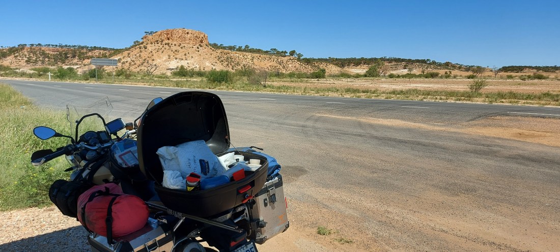
The nearly 1200 km of rough dirt roads had destroyed the bikes rear tyre and drive chain.

So new tyre and chain and time to make miles to the east coast of Australia

Past the Devils Marbles

Over the Queensland border.

And along hot straight outback roads

To Longreach

Some call Longreach the capital of the Outback

The home of QANTAS now Australia’s national airline.

It’s also the centre of the Chanel Country that funnels the water of the tropical monsoons into Lake Eyre in the centre of Australia.

Which I has passed only a few weeks past

So I took a friend for a ride

To see the water lillies on the flooded Thompson River as the precious water makes its way to the desert

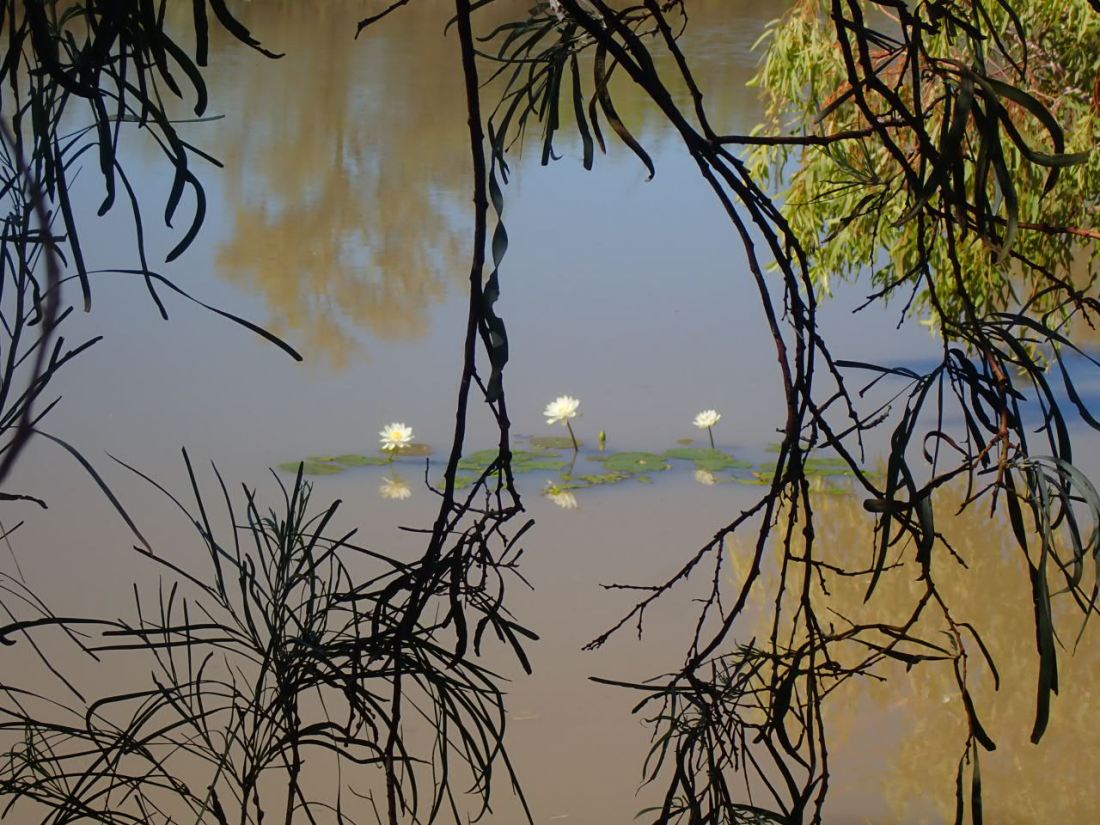
I was going to take a swim but the river was full of mud from recent floods and not inviting.

Tomorrow I will start to make miles again. Four days of riding in temperatures of 37c ( nearly 100F) had zapped my energy.

An air-conditioned hotel a respite. My blogs up to date, I’m refreshed and tomorrow offers cooler weather as I head south east toward the Pacific Ocean.

Central Australia Adventure 12 – Uluru and Kata Tjuta

The Uluru – Kata Tjuta National Park in many ways the centre of Australia

Uluru the largest monolith in the world.

Constantly changing colour and tone as the light hits it.

To see it shine red during sunset it amazing

To see it at sunset with the March full moon rising on the equinox truly spiritual.

The walk around the base of Uluru is approximately 10.5 km.

Uluru is a sacred place for Aboriginal Australians and being close to it one feels the sacred power of the rock that is ever changing in colour and mood.

Each crevice, crack, cave and stain tell part of an Aboriginal dreamtime story.

Stories often told in drawing in the rock caves.

Kata Tjuta is approximately 40 km from Uluru. A series of sandstone rocks through which valleys wind.

The Valley of the Winds walk is an approximately 7km walk through the rock outcrops

As I sit in a hotel room in Longreach, Queensland, reflecting on the two weeks spent immersed in the Red Centre a shiver still goes down my spine.

It took me almost a lifetime to get here but I may yet be back.

Central Australia Adventure 11 – Watarrka or Kings Canyon

There are two ways to travel between Alice Springs and Kings Canyon. The long way down the Stuart Highway or the short rough way on the dirt Mereenie loop road.

Road both but only the loop road was worth a picture!

Mereenie Sandstone formed in Central Australia about 400 million years ago.

By the size of the corrugations on the loop road that was the last time the road was graded!

The loop road leads directly to Watarrka National Park which includes Kings Canyon

The Rim Walk is a spectacular walk of around 8 km around the rim and into Kings Canyon

The views looking out from and across the top of the Canyon rim are amazing

Looking into the Canyon one can only marvel at the power of nature to cut so precisely the ancient sandstone with only water and wind as tools.

And when walking down into the Canyon floor

Where water flows and plants flourish there is a beautiful cool calmness silent away from the heat of the Rim.

Kings Canyon is one of the major destinations in Central Australia. I think you can see why.

Central Australia Adventure 9 – the red/green centre – East MacDonnell Ranges

For the last couple of weeks I have been  immersed in the Red Centre of Australia.

Literally immersed as the rivers, creeks and waterholes in the MacDonnell Ranges are brimming after recent rains

The MacDonnell Ranges flank Alice Springs to the east and the west.

A line of rolling mountains, as old as time itself,
Punctuated by, gorges, gaps, passes and chasms


Red and ocre rock forged into mountains by rain wind and salt over the millennia.

This journey of discovery of the Red Centre starts and finishes in these ranges so let’s start the story in the east MacDonnell Ranges.

To the east the ranges run out to the Trephina Gorge Nature Reserve.
Emily and Jessie Gaps/ Yeperenye are only a short 22km ride east of Alice Springs.


These sites have important cultural rock paintings that tell the dreamtime stories of the local Central Arrernte people.

Their dreamtime stories are represented in rock paintings at these sites. People are requested not to photograph them. So you will have to go and see them yourselves.

Corrobaree Rock was formed hundreds of millions of years ago

When central Australia was covered by sea and sand and salt formed a motar to bind these rocks into a new form.

The ghost gum is such a symbol of central Australia and this one at the entrance to Trephina Gorge is over 300 years old.

Trephina Gorge really was a perfect first taste of the magnificent canyons and gorges that were to come.

As an addendum for those following my actual where about. I left Alice Springs yesterday and now on the way to Queensland. The next few posts will be reflections on the Red Centre.