The World Heritage Purnalulu National Park aka the Bungle Bungles.

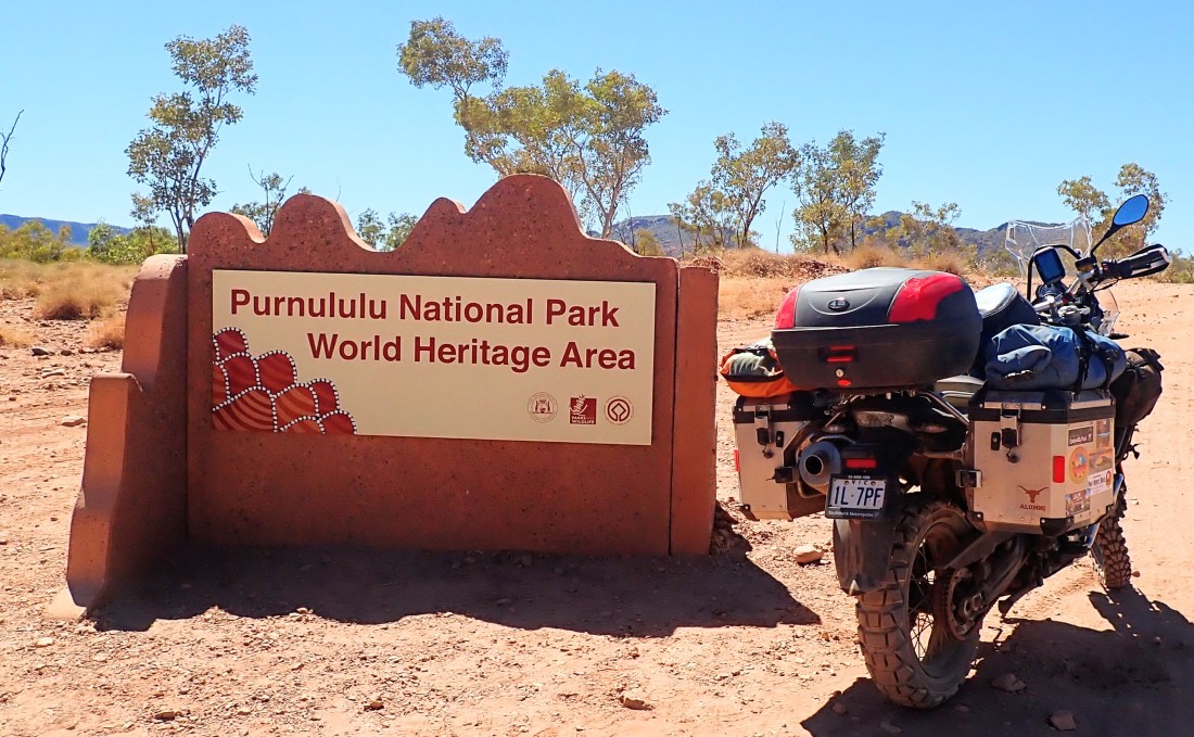
The Purnalulu National Park contains a number of unique rock formations one of which is the Bungle Bungle Ranges.

It’s 53 km from the Northern Highway into the Park and I have to say possibly the most challenging 53 km I have ridden this trip.

The road was extremely rough with 4 water crossings 2 quite deep.

https://videos.files.wordpress.com/0fYDWwvW/wp-1708318477797.mp4

As this 4wd came through the first water crossing (above) my heart started thumping as I thought this is a challenge.

At the third, and deepest crossing I thought I was beaten. I let a 4wd go through. The next thing it was stopped at the top of the embankment and the driver is down into the water.

“You can do it. I’m.a biker too. Keep to the left side there are less rocks”

“This is the deepest part” he said, standing thigh deep in water. “You can do it”

And I did as he talked me through the crossing.

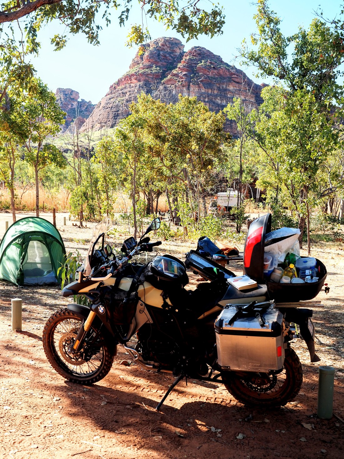
I set up camp at the Kurrajong campground and the view of the Bungle Bungles at sunset told me the ride in was worth it. I was looking forward to riding out to the walking areas the next day.

The Bungle Bungles are unique rock formations formed around 300 million years ago.

The colours and contours of the landscape just breathtaking.

At the northern end there are huge gorges of red firey rock

https://piecemealadventurer.com/wp-content/uploads/2021/08/oi000947.mov

The Northern walk (above) are is named Piccaninni after the creek that cuts through the land scape and is noted for its dome shaped rock formations and steep gorges. Cathedral and Whip Snake were the ones I visited.

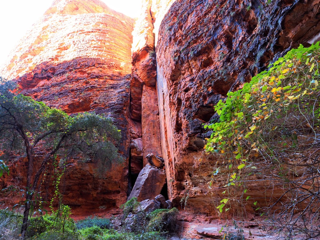
The southern walks are characterised by amazing chasms. Echidna chasm is a thin passage through the 200 metre high cliffs.

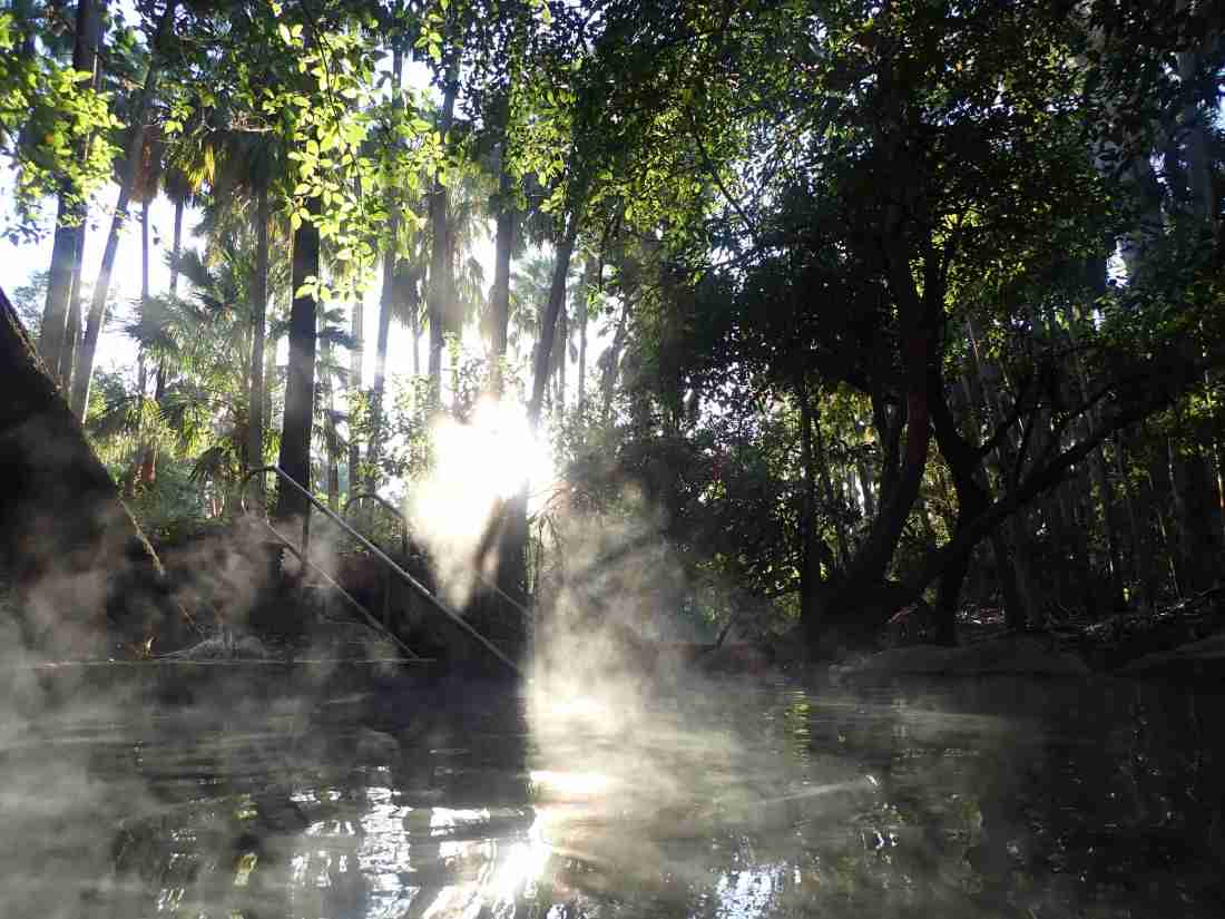
The southern chasm entrances provide the perfect environment for the Livinstona Palm

Especially in the Palm Valley.

Purnalulu was a special way point on this trip and what an overwhelming beautiful place to visit.

I was even lucky enough to have a fellow biker for company.

Back heading west on the Savannah Way and a stop at Keep River National Park

The savannah woodlands stretched out to the horizon.

Crossing the big rivers I didn’t need a sign to say I was back on the Savannah Way.

Just before the Northern Territory/ Western Australia border there is the Keep River National Park.

About 18 km in from the Rangers station is the main camping ground.

A special part of North Western Australia is the amazing rock formations.

There are a number of walks through the rock canyons at Keep River. I will give you a taste of these beautiful rock formations.

From the lookout the rocky range stretches out through the savannah

The stunning colours of the rock and landscape.

And there is the beautiful Rainbow Bee Eater, flitting around the forest.

As the sun sets the rocks turn red reflecting the setting sun’s fire.

When the light is gone the Milky Way fills the sky.

There is nothing like the stars in the outback.

So I’m now sitting in Kununurra, in the State of Western Australia. Supplies have been purchased ready for the next outback leg of my journey.

Nitmiluk NP 3 – the Arnhem Land Plateau and Aboriginal Rock Art

There are significant sites of rock art all around the Nitmiluk NP.

There are sites in the public access areas of the Gorge

There are remote areas accessible only by helicopter

And special areas only accessible with aboriginal guides, in remote communities. Unfortunately due to Covid 19 access to remote aboriginal communities is not available.

The Arnhem Land Plateau is amongst the oldest exposed rock in the world.

Being formed 1,600 million years ago.

In the wet season the sandstone acts as a giant sponge soaking up the flooding waters that flow as springs and waterfalls in Nitmiluk and Kakadu in the dry season.

We landed at a spring atop the Arnhem Land Plateau

Around the spring were six galleries of aboriginal art

This was a place for dreaming hence the yellow Mimi spirit, catching fish, and giving birth.

I can’t capture the galleries painted thousands of years back are.

In the main Gorge the rock art is more accessible

For us, non aboriginal people this art are interesting images.

For aborigines they tell a story of how the land was formed and changed over tens of thousands of years

How to find food and water in the wilderness.

How to live as one with the land.

Nitmiluk National Park 1 – Edith Falls

There are two major accomodation hubs in the Nitmiluk NP a small campground at Edith Falls and camping , cabins and 5 star lodges at Katherine Gorge.

Edith Falls campground sits beside a big lagoon at the bottom of a series of waterfalls where the Edith River cascades downward off the Arnham Land Plateau.

The Upper Falls swimming hole is at the top of the escarpment

But the Edith River has more treasures further up stream.

An appropriate 2km walk along the top of the Plateau is the Long Pool.

A perfect place for a natural spa

A further 2km along the trail is Sweet water

A lovely swimming hole it is also the final camping spot on the Jarbulla trail.

You can also walk up from Edith Falls campground and camp overnight at Sweetwater.

The swimming whole that will stick in my mind though is the Long Pool

There are no reservations at the Edith Falls campground so it’s best to get there early as the sites go quickly.

The kiosk is really friendly for checking in and healthy snacks

If you don’t want to hike to swim the main swimming hole.

Which at sunset turns an amazing shade of red at sunset.

Into the Northern Territory- more hot springs, how can life be so hard!

I was running short of supplies to find a supermarket.

Nearest supermarket – 550km by mainly sealed roads or 334 by mainly dirt roads.

So it was back on the dirt roads again and refreshed by the healing waters of Boodjamulla it was time to make big distance.

A stop at Riversliegh (https://en.m.wikipedia.org/wiki/Riversleigh_World_Heritage_Area) the world heritage fossil site.

Through river crossings

And onto the city of Mount Isa.

Refreshed from my swimming at Boodjamulla is time was time to make miles.

Some Covid outbreaks in Queensland influencing my decision to get west while I could.

I covered the just over 1,600km to Mataranka hot springs a 2 and a half days.

Met up with some fellow bikers on the way

Joined up again with the beautiful Savannah woodlands

And celebrated being back in the Northern Territory with a soak in the hot thermal waters of Mataranka on a moonlight night.

And how could I resist a dawn swim!

The steam rising of the thermal water in the cool morning air.

Border entry into Western Australia is very strict with a requirement to be in the Northern Territory (classified covid low risk) for 14 days before entering.

Nitmiluk National Park was my next stop and where I have spent most of my current time in the Northern Territory.

My next few posts will cover this amazing piece of Australia.