A visit to Gariwerd ( The Grampians)

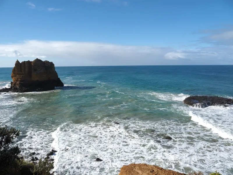
Gariwerd, in Victoria, is the southwestern tip of the Great Dividing Range that runs 3,500 km up the east coast of Australia.

Its a beautiful place for riding the back roads, walking in beautiful bushland, and taking in the views from mountain top lookouts.

Geriward is also a place of significance for Australian Aboriginals. There are over 200 sites of Aboriginal Rock art in Gariwerd. It has the largest number of rock art sites in southern Australia.

Gariwerd can be translated as meaning Mountains created by Bunjil. Bunjil is part of the Aboriginal creation story.

I visited a couple of sites on this trip.

‘Bunjil shelter’ is the only known representation of Bunjil with two dingo helpers.

Ngamadjidj is another site that is accessible.

The art is generally found in rocky outcops in Gariwerd.

There are beautiful walks through the forests…

To waterfalls…

And mountain top views…

For the motorcyclist, the riding both on and off road is excillerating.

Gippsland -Eastern Victoria

The major natural attraction in South Gippsland is Wilsons Promontory Naional Park (The Prom). A mountainous Promontory that juts out into Bass Strait.

But west of the Prom, between the lighthouse on Cape Liptrap and the Prom is Wararah Bay. A beautiful stretch of sandy beaches and rocky headlands.

On the western side of The Prom, there are the historic ports of Port Welshpool and Port Albert.

Port Welshpool above and Port Albert below provide access for all types of sailors to the sheltered waters of Corner Inlet at the northern end of The Prom.

I think the fish and chip restaurant on the jetty at Port Albert serves the best fish and chips in Australia!!! A big statement!

Just east of Port Albert is the western end of 90 Mile Beach. An uninterrupted sand beach that stretches 94 miles (151km) to Lakes Entrance. Its the longest beach in Australia and 3rd longest beach in the world.

The sand is beautiful yellow stretching on over the horizon.

Some local beaches are very popular with little villages and Surf Lifesaving Facilities for safe swimming on the wild coast.

Other sections are only accessible down rough, narrow tracks with the help of local knowledge..

Testament to the wild seas are skeletons of wrecks burried in the otherwise pristine beach.

Its a short distance north into the southern foothills of the Great Dividing Range and its high mountains and rivers that flow down to the Gippsland Lakes.

Near the town of Briagalong is the beautiful Blue Pool swimming hole in Freestone creek.

With a small campground, a short walk from the pool. A perfect spot for foe gazing at the moon while sitting beside the camp fire.

The Mitchel River National.Park is between the towns of Briagalong na Dargo.

The Mitchel River is the last wild river in Victoria and the national includes a beautiful river gorge and the southern moste temperate rain forest in the world.

The temperate rain forest is part of an aboriginal sacred sight- the Den of Nargun.

Its a 5km loop walk down into the Den of  Nargun and to the Mitchel River and returning via the bluff lookout.

At the end of summer, the waterfall over the Nargens Den is only a trickle.

The track to the river is along the creek through the rain forest with a series of water holes.

The Mitchel Rivers flows slowly through the gorge. Beautiful for a swim!

The final stage of the walk is a steep climb out of the gorge, where there is a beautiful view over the gorge.

The Mitchel River NP, is along the road to Dargo in the Great Dividing Range. It runs along the Wonnangatta River. There are a number of places to camp along the river both south and north of Dargo.

The mornings by the river may be misty but the nights in the mountains are clear. Perfect for sitting by the camp.fore and gazing at the Milky Way through the tree canopy.

Further up into the mountains, the forest becomes thicker.

The forest provides homes for Australia’s beautiful birds.

The dirt road from Dargo to Mount Hotham crosses out of East Gippsland and into the Victorian Alps.

On the top of Mount Hotham (1860 mtrs), it’s close to the top of Victoria with amazing views over the mountains.

These are relatively remote part of Victoria but well worth visiting.

Otway Rangers Rain Forest, Victoria, Australia.

The film ‘Force of Nature‘ has recently opened in Australia. Parts of it were shot in the beautiful temperate rain forests of the Otway Ranges.

Hopetoun Falls features in the movie. Its currently approaching summer, so the waterfalls in the ranges are flowing slowly. Some, like Henderson Falls, gently cascade over the cliff face.

Henderson Falls, are near a rocky feature in the ranges named The Canyon. I think I recognised it in the movie.

Its a beautiful walk through the forest to reach the Canyon in a quiet part of eastern end of the ranges.

The western end of the ranges faces the incoming weather and is a thicker forest.  With more Beech trees, ancient Beech trees.

The Otways are a mountain range that abuts the sea. The Southern Ocean, to be precise.

So after a long hike on a hot day, it’s easy to cool off  with a swim in the cool ocean waters.

I camped a couple of nights at Apollo Bay, which sits on the ocean about halfway along the ranges.

It’s a beautiful town, at night as dark slowly descends over the harbour.

Or as the sun rises over the rolling surf.

Eric Bana is the star of ‘Force of Nature’

But you will have to endure having me in the starring role here.

A small tour in Victoria’s High Country.

Victoria’s high country is about my favourite riding ground in Australia. I’ve ridden most of the roads in the region and in the nearby Snowy Mountains, but there were a couple of dirt roads that run between three iconic high country towns; Corryong, Omeo and Dargo, that I was yet to ride.

It was a good chance to try out my new Moto Guzzi V85tt adventure bike.

I camped the first night at the Eskdale Caravan Park and had a lovely site right beside the Little Snowy Creek.

John, the publican at the Eskdale Hotel, is a keen adventure bike rider and a reliable source of information on the state of all the local trails.

Armed with local knowledge, I decided to take the scenic Great River Road that runs beside the Murray River. Toward Corryong.

Along this road, there are beautiful roadside stops with views over the river valley with tables for a picnic lunch.

There are sculpture along the road and in the back ground of the above photo you can see a Bogong Moth sculpture.

My favourite sculpture along this road is the Murray Cod sculpture at Tintaldra.

The sculture is mounted on the remaining structure of the old bridge. The photo is from the new bridge.

Enough sightseeing it was now time for some serious riding on the Corryong -Omeo Road.

Its a good quality gravel road that allows a good pace to be maintained and I was into Omeo late afternoon and set up in the camp ground beside Livingstone Creek

After a hot dusty ride the creek swimming hole was the perfect spot to wash off the dust and cool down before dinner. (Ps I had a special request for a swimming selfie!)

I met some friends for dinner at the Hilltop Hotel, which has an interesting piece of taxidermy.

From Omeo to Dargo its only 50km of dirt through the mountains. Dargo is an iconic village in the high country, and I was excited to get there. The dirt road goes over Mt Birregun, a 1350m high mount in the Victorian Alps.

Its a beautiful ride.

Thr Dogs Grave Reserve is a special stop along the route.

The pioneers planted walnut trees around the village, and the main street is lined with old Douglas Fir.

And, of course, there is the Dargo River.

The run home took me through the beautiful Yarra Ranges and its temperate rain forests, tall trees, and giant tree ferns.

Arriving back in time for NYE.

https://videos.files.wordpress.com/RYdLCieN/wp-1704106533384.mp4

Even in Winter -the GOR is a great ride.

Even in winter the Great Ocean Road is a great ride

The joy of a midweek ride in winter the road is pretty much empty. It allows the rider set up a rhythm on the road. Smooth riding over the damp road and around the tight corners.

With dark clouds foreboding Apollo Bay and its little fishing harbour is a welcome destination.

But it was soon into the Apollo Bay Eco Hostel and its welcoming warmth.

In Victoria that faces the Southern Ocean the weather doesn’t settle for long.

The next day was clear and calm. Perfect riding weather along a near perfect riding road.

There is a lookout at the back of Lorne there a fantastic view over the ocean.

On this day the sun was in the perfect spot to light rainbows in the spray of the breaking surf.

For me the best riding on the GOR finishes ar Airies Inlet. From the the villages but up against each other with only glimpses of the great Ocean over the houses and dunes.

The Airies Inlet Light House the last stop before heading home to Melbourne.

Hard to believe it was winter.

In Melbourne, I’m lucky enough to live by a little harbour and can take a walk on a summers day and admire the wooden boats.