A sojourn in South East England

The shingle and high tides are the perfect conditions for having a careening based shipyard at the old fishing port at Hastings.

Trawlers sit on the shingle while their catch is sold in the huts on the foreshore.

The fishing port and old town sit under high cliffs where a funicular to the top of the cliffs gives a great view.

And the old town has the buildings that are so out of square that I wonder how they have stood for a week yet they have for centuries.

Old out of square Tudor style building are part the village of Rye. Especially, the beautiful Mermaid Street.

And around Church Hill where some of the oldest buildings in the village are found.

Once the sea lapped at the edge of the town of Rye but that was many many centuries ago. The beach is now a couple of miles down the Rother River with marshland in between.

From the mouth of the Rother the shingle beach curves gently for just over 10 miles to the the cliff at Fairlight.

The tide of 4 metres means an ever changing view along the beach. It also means ever changing water conditions.

My favourite little beach is at Pett Level especially at high tide where the drop away from the high tide line is steep. This means on a hot day a couple of steps off the shingle and you can plunge into the cool Atlantic waters in the English Chanel.

Fishing is part of the culture of the South East be it the small fishing boats on the shingle at Pett Level

Or the commercial boats like at Hastings and at Rye.

And bounty from the sea such as a pan of plump fresh scallops.

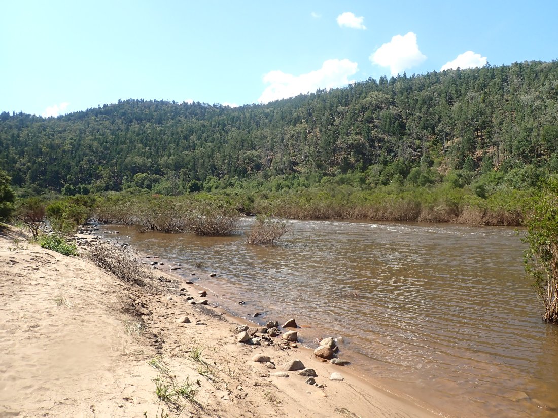
Upstream of Rye, the Rother River winds its way through the country side.

Past little villages like Newenden where the local pub provides a spot for a cool ale or bite to eat.

But, for me, the most special place is the Rye Nature Reserve. With its walks, wildflowers and birdlife. It was my solice when I was locked down in Rye Harbour in April 2020. It is a most beautiful place.

There has recently been a heat wave in the UK and Europe. Rye Harbour was the perfect place to escape the heat and to see the storm to end of the heat wave roll in.

The run south to the Moroccan desert

Heading south east from Chefchouan through the middle Atlas there was warning of the hot dry run ahead.

Morocco has been in a drought for the last three years and the signs were there to tell getting drier every kilometre travelled south.

The mighty rivers were streams, streams were dry and in the dust of dry oasis the date palms struggled for survival.

Heading through the towns of Zaida, a bustling highway town, and Midelt, with its big apple, the trucks full of hay and the produce in the roadside stalls added colour to the scene but the air was dry and dusty.

But I guess it was coming down the Ziz Gorge and seeing the Ziz river just flowing bought home to me the extent of the drought.

Droughts are something we are used to in Australia.

Along the Ziz the date palm plantations still looked green

By Rissani 600 km further south and Zegora, futher on, the green had faded.

But this far south it’s the edge of the desert and that has its own charms.

And the hotels which are largely good and well priced offer there own little oasis.

M’hamad is the end of the road leading to the desert. The wonderful sand sea of Chegaga (see a couple of blogs back.)

The M’hamad oasis was bone dry scorched by the sun even as it set.

With Adventurers setting out into the desert in search of their dream in this nomadic life.

Riding the ships of the desert in the biggest sand sea in Morocco – Erg Chegaga

M’hamid el Ghizlane is at the end of the road the leads into the dessert.

It’s a strange way to start a story about going to Morocco at the end of the road into the desert at a town only 40km from the closed Algerian border.

But this is discontinuous narrative and at some stage I will get back to the start of the journey.

But getting to the desert and it’s nomadic herders was a dream for me.

At M’hamid the mighty breva was garaged while the crew at https://www.desertbivouac.com/ took control.

The Erg Chegaga is the biggest sand sea in Morocco and a perfect place get the feel of the desert.

At the one of the small oasis, or…

Or riding a ship of the desert in a sand sea.

Riding the waves of sand up to 300m high.

Waves that change colour with the setting sun.

To time this adventure with a desert full moon was extra special.

And to sit on a Berber carpet in the desert listening to the sounds of Bedouin singing and drumming beside the camp fire under its silver light

This has to be one of my most amazing travel experiences. So thanks to Desert Bivouac

Australia’s borders are open, its autumn, and time to contemplate Northern Hemisphere Travel

Summer has flowed into autumn in Melbourne, Australia

At my local beach the water is cool and clear

So clean you feel like you could reach out and grab a handful of sea lettuce and just munch it

But in late February, Australia’s international borders opened post covid and my mind had turned to travel again to the Northern Hemisphere and the motorbike I have stored in England

Time for another European Adventure , and maybe with a touch of North Africa.

It was time to get used to riding my Moto Guzzi Breva 1100 again. The same bike as I have in England.

The Mighty Breva was 3,000 km short of its next service. Perfect for a return trip to NSW to enjoy that beautiful part of Australia and catch up with friends.

So it was time to hit the highway and byways.

Pick up some uninvited company on the way

Then head over the Waterfall Way

To the Northern NSW Coast.

I still believe the beaches of Northern NSW are the best I’ve seen in all my travels. Unfortunately due to the heavy recent rains the water was a murky brown rather than the usual blue.

The Arawarra Fish Traps are a legacy of the aboriginal aquaculture in this area.

At high tine the traps are hardly visible.

But at low tine the intricate stonework of the traps are revealed.

And a trip to this area is not complete without a ride in the mountain rainforest.

Unfortunately the changeable and wild weather that has been happening on Australia’s east coast cut my time and I had to come back to Melbourne early.

As I had a swim this afternoon this tern was flying overhead.

Its soon time for me to fly

In a couple of weeks its across the world to England to see my sister, collect my Moto Guzzi Breva 1100 stored there and then head across Spain to Morocco to recommence the journey of adventure there, which was cut short by pandemic in 2020.

The mountains and the sea of South East Australia. Part 2 – water flowing to sea

Rivers are like arteries of the land

The water they carry the life blood

Water is life!

Something we should never forget.

The Murray River, the longest river has its head waters in the mountains of South East Australia and wends a long path west before crossing through three states to meet the sea.

But these mountains don’t take their from the Murray but share a name called Snowy.

The Snowy Mountains and the Snowy River are both known for their wild beauty

The Snowy River originates on Mount Kosciuszko and flows 352km to the sea at the 90 mile beach at Marlo.

The Snowy was a wild river now somewhat tamed by being dammed at Lake Jindabyne.

When I was younger I walked the trail to the peak of Mount Kosciuszko from the ski resort town of Thredbo.

This trip was a ride through the mountains south to follow the river from Lake Jindabyne to the sea,

The route was through the southern sections of the Kosciuszko National Park and into the Snowy River National Park camping at the famous McKillops Bridge.

The campground sits just above the river with a little beach on the Snowy River

McKillops Bridge is a long narrow wooden bridge opened in 1935 that spans a low gorge of the Snowy River and links remote villages in the mountains of South Eastern Australia.

Originally McKillops Bridge was to open in January 1934 but a huge flood sent a 14 metre high wall of water down the Snowy River lifting the wooden top structure off the concrete pylons. The rebuilt bridge was designed to withstand a 17 metre flood. Not that that is likely now the wild river has been tamed by Lake Jindabyne.

The Snowy River National Park is home to smaller rivers, tributaries and deep gorges in the mountains, reflectiong the wild remoteness of these mountains.

At the little village of Marlo the Snowy meets the sea

At Corringle Beach on the Marlo Estuary sits an old slipway where the boats that used to ply the old wild Snowy were pulled up for repairs.

An immature Osprey standing guard over the estuary

A small line of sind dunes separates the estuary

from the 90 mile beach and the wild sea that pounds it.

The Snowy drops from around 2000 metres high in its short 350kilometre journey to the Ocean. No wonder it was a wild river.